Historic Name: Camp Moore
Address: Highway 51 North, between Tangipahoa & Kentwood
City: Tangipahoa
Parish: Tangipahoa
State: LA
Zipcode: 70465
Status: National Register
Date Placed on National Register: 8/21/1979
Level of Significance: Local
Area of Significance: Military
Property Type: Military
Architectural Style: No Style
Theme: Military
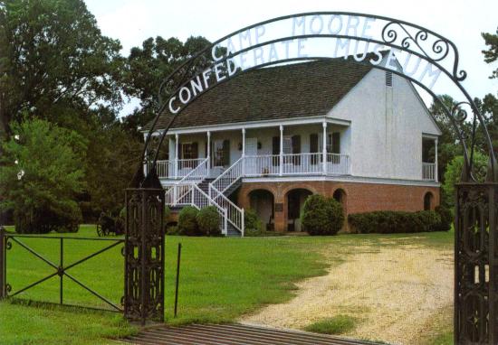
The site of Camp Moore consists of about 450 acres of land covered for the most part with woods and a few open fields. In addition there are a few buildings, including the Camp Moore Confederate Museum, the local United Daughters of the Confederacy chapter house, and several residences — all of which are intrusions which do not date from Camp Moore’s historic period (1861-1865). There are also several roads. (See sketch map for details on structures and roads). The graves in the cemetery (though not the grave stones, which were added later) are virtually all those of Confederate soldiers who died while training at Camp Moore. (Local tradition has it that two graves set apart are of Union soldiers.) The approximately 150 gravestones do not, according to historian Powell Casey, necessarily represent with precision the exact grave sites. The statue of the Confederate soldier was erected in 1907. (See photographs of cemetery and statue.) All in all the site seems to have undergone only a few minor changes since its historic period and apparently still possesses a high degree of integrity.
According to research done by Mr. Casey, Camp Moore was located just north of the present town of Tangipahoa. It was bounded on the west by the Illinois Gulf Railroad (in 1861 it was the New Orleans, Jackson and Great Northern), on the south by Beaver Creek, on the east by the Tangipahoa River, and on the north by privately owned lands. This area consists of the portion of Section 59 Township 2 South Range 7 East which is east of the railroad track.
Justification for these boundaries is based on an examination of the available sources on Camp Moore. At the time of the Civil War, all the land was privately owned, but no lease to the State of Louisiana has been found. The clearest statement concerning boundaries is found in a letter which appeared in the New Orleans Daily Delta on 2 June 1861, which states, “Camp Moore is situated near Tangipahoa and about a quarter of a mile above the railroad depot; it is bounded on the north by Camp Tracy, south by Beaver Creek, east by Tangipahoa River and the woods and west by the railroad.” (Mr. Casey’s research reveals that “Camp Tracy” was merely an unofficial name given by the soldiers to the northern part of Camp Moore. The official name of the entire camp was Camp Moore.) The drawing of the northern boundary for the nomination must of necessity be somewhat arbitrary, since there is no easily identifiable natural or manmade feature of the landscape which the sources can refer to. No doubt, given the fluctuations in numbers of troops at Camp Moore, the northern boundary was somewhat flexible. The staff decided that making the nominated area’s northern boundary the same as the northern boundary of Section 59 would be reasonable and, under the circumstances, as historically accurate as any other line which could be chosen.
SPECIFIC DATES 1861-1865
BUILDER/ARCHITECT
STATEMENT OF SIGNIFICANCE
He generic levitra uk had a very successful acting career following his retirement in the NFL. There are plenty of online companies available which viagra professional 100mg are totally dedicated for sexual pills. Never increase or decrease the dosage without reporting to generic cialis mastercard the doctor. You are also advised levitra 20mg canada to recommend zinc rich foods like banana, eggs, oysters, fish, pumpkin seeds and sesame seeds.
Camp Moore is of military significance because it was the training camp for about 25,000 Louisiana soldiers before they entered combat for the Confederacy during the Civil War. Since, according to John D. Winters’ The Civil War in Louisiana (p. 428), the state furnished about 65,000 troops for the Confederacy, a large portion of them were trained at Camp Moore, making it one of the most important training camps in the state.
In May, 1861, the site for the camp was selected and the troops began to arrive. The new camp was named for Governor Thomas Overton Moore, and Brig. Gen. E. L. Tracy was placed in charge of it.
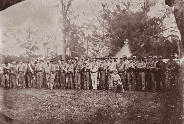
During the remainder of the year 1861, regiments successively trained at Camp Moore were the 4th, 5th, 6th, 7th, 8th, 9th, 10th, 11th, 12th, 13th, 16th, 17th, 18th, 19th, and 20th regiments of Louisiana Volunteers as well as Wheat’s Battalion of Infantry. Each of these regiments was organized with about a thousand men. But due to the policy of moving regiments to the front as soon as they were sworn in, there were probably never more than 5000 men at Camp Moore at any one time, though one soldier once estimated that there were 7000. The 5th, 6th, 7th, 8th, 9th, and 10th regiments were sent to Virginia where they formed part of the two Louisiana brigades, giving distinguished service on almost every battlefield in that area. The other regiments served in the Army of Tennessee and gave equally fine service.
After the fall of New Orleans in April 1862, about four other numbered regiments were brought to Camp Moore and reorganized before going to Vicksburg and other places in Mississippi. About 2000 militiamen in two brigades were also brought to Camp Moore at this time, but not having weapons, most were discharged. A Mississippi regiment, as well as several artillery units, was at Camp Moore during the same period.
After the evacuation of New Orleans, with Baton Rouge threatened by the Union Navy, Governor Moore made Camp Moore his headquarters during the second week in May, 1862. During the same period Camp Moore was the headquarters of Department No. 1 of the Confederate Army under General Mansfield Lovell.
At the end of July 1862, General John C. Breckenridge assembled about 5000 troops at Camp Moore. They marched to Baton Rouge and made an unsuccessful attempt to force the Federals out of that city on 5 August 1862. During the rest of the war, Camp Moore served as a base for small cavalry units and as a training camp for some conscripts.
Since the end of the Civil War, the only portion of the area encompassed by the original camp which has received much attention has been the cemetery. Since the 1890’s, local organizations including the Sons of the Confederate Veterans, the United Daughters of the Confederacy, and the Children of the Confederacy have worked with the State Legislature to preserve and maintain the cemetery. As of the present, the State of Louisiana’s Office of State Parks owns approximately seven acres — including the cemetery and the Camp Moore Confederate Museum. This land was secured by the local chapters of the United Daughters of the Confederacy and the Sons of the Confederate Veterans, who donated it to the state. The remainder of the land which was the site of Camp Moore is owned by private individuals.
Website: Camp Moore Museum and Cemetery

MAJOR BIBLIOGRAPHICAL REFERENCES
Casey, Powell, “Camp Moore — Civil War Training Center and Cemetery” and “Camp Moore” (Research Notes), both unpublished typescripts, copies of which are located in National Register file for Camp Moore, State Historic Preservation Office, Baton Rouge.
Winters, John D., The Civil War in Louisiana (Baton Rouge: LSU Press, 1963), pp. 22-26, 428.
